
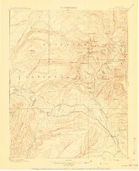
1908 Map of La Plata
USGS Topo · Published 1946About this map
The Rio Grande Southern R. R. serves as the industrial backbone of this mountainous landscape, winding through the southern half of the quadrangle to connect high-altitude resource extraction points. Deep within the Montezuma National Forest, the map documents a robust mining economy, particularly in the northeast around the Cumberland Basin. Here, the Cumberland Mill and Columbus Mine operate amidst a cluster of peaks including Hesperus Peak and Mt. Moss.
Find a feature on this map
88 named features on this map. Tap any name to fly to it.
Don’t see what you’re looking for? This feature index may not catch every label — zoom into the map to look around manually.
Map Details
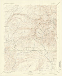
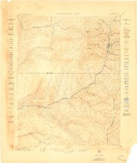
Editions of this 1908 La Plata Map
3 editions found
Other maps of this area

1895 · La Plata
USGS Topo · 1:62,500

1897 · La Plata
USGS Topo · 1:62,500

1897 · Rico
USGS Topo · 1:62,500

1898 · Durango
USGS Topo · 1:62,500

1898 · Engineer Mountain
USGS Topo · 1:62,500

1898 · Rico
USGS Topo · 1:62,500

1899 · La Plata
USGS Topo · 1:62,500
1899 · Rico
USGS Topo · 1:62,500

1900 · Engineer Mountain
USGS Topo · 1:62,500
1907 · Durango
USGS Topo · 1:62,500