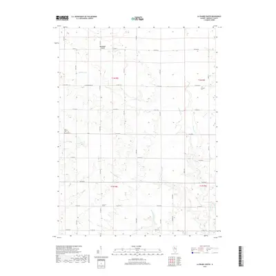
2018 Map of La Prairie Center
USGS Topo · Published 2018About this map
Saratoga Center and La Prairie Center anchor this agricultural landscape in Marshall County, illustrating the enduring township-and-range settlement pattern of central Illinois. The terrain is defined by an intricate network of waterways including Senachwine Cr and its tributaries, such as Little Senachwine Cr and Scholes Br. These streams carve through the prairie, creating a drainage system that includes Camp Run, Mud Run, and Thenius Cr. For local historians and genealogists, the map identifies specific burial sites such as Saint Patrick Cem and Mansfield Cem, which serve as quiet markers of the area's early families. The road network, primarily composed of rural routes like Western Rd and Hampton Rd, follows the cardinal directions, reflecting the structured grid system used to organize the Illinois farmland during its development.
Find a feature on this map
36 named features on this map. Tap any name to fly to it.
Don’t see what you’re looking for? This feature index may not catch every label — zoom into the map to look around manually.
Map Details
Editions of this 2018 La Prairie Center Map
This is the sole edition of this map. No revisions or reprints were ever made.
Other maps of this area

1893 · Lacon
USGS Topo · 1:62,500

1893 · Metamora
USGS Topo · 1:62,500

1893 · Dunlap
USGS Topo · 1:62,500

1898 · Dunlap
USGS Topo · 1:62,500

1932 · Dunlap
USGS Topo · 1:62,500

1933 · Dunlap
USGS Topo · 1:62,500

1933 · Lacon
USGS Topo · 1:62,500

1933 · Camp Grove
USGS Topo · 1:48,000

1937 · Metamora
USGS Topo · 1:62,500

1937 · Dunlap
USGS Topo · 1:62,500