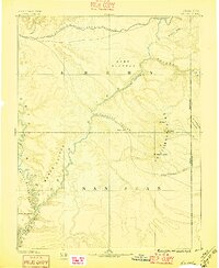
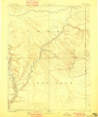
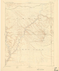
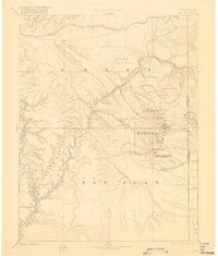
1885 Map of La Sal
USGS Topo · Published 1896About this map
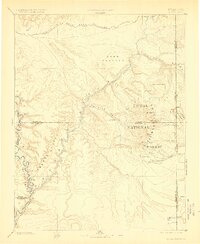
The Grand River and Green River converge in this late 19th-century landscape, marking the dramatic transition into Cataract Canyon. The settlement of Moab is established within the Spanish Valley, serving as a vital junction point below the towering La Sal Mountains, where peaks like Mt Peale and Mt Waas dominate the eastern horizon. The northern reaches of the map show the path of the Denver and Rio Grande Western Railroad as it crosses the high desert near Bitter Water Creek.
Find a feature on this map
27 named features on this map. Tap any name to fly to it.
Don’t see what you’re looking for? This feature index may not catch every label — zoom into the map to look around manually.
Map Details
Editions of this 1885 La Sal Map
6 editions found
Other maps of this area

1885 · San Rafael
USGS Topo · 1:250,000

1885 · East Tavaputs
USGS Topo · 1:250,000

1885 · La Sal
USGS Topo · 1:250,000

1886 · Henry Mountains
USGS Topo · 1:250,000

1886 · Price River
USGS Topo · 1:250,000

1886 · Abajo
USGS Topo · 1:250,000

1892 · Abajo
USGS Topo · 1:250,000

1892 · Henry Mountains
USGS Topo · 1:250,000

1893 · Abajo
USGS Topo · 1:250,000

1896 · Price River
USGS Topo · 1:250,000