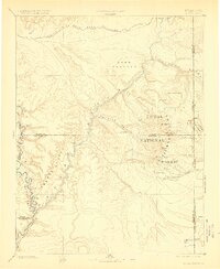
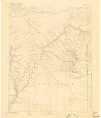
1885 Map of La Sal
USGS Topo · Published 1923About this map
Moab and the winding Grand River serve as central points in this late nineteenth-century reconnaissance of the high desert along the Utah-Colorado border. Compiled from the foundational work of the Powell and Hayden surveys, the map illustrates a landscape of immense verticality, from the high peaks of the La Sal Mountains, including Mt Peale and Mt Waas, down to the deep incisions of Stillwater Canyon and Cataract Canyon.
Find a feature on this map
30 named features on this map. Tap any name to fly to it.
Don’t see what you’re looking for? This feature index may not catch every label — zoom into the map to look around manually.
Map Details
Editions of this 1885 La Sal Map
6 editions found
Other maps of this area

1885 · San Rafael
USGS Topo · 1:250,000

1885 · East Tavaputs
USGS Topo · 1:250,000

1885 · La Sal
USGS Topo · 1:250,000

1886 · Henry Mountains
USGS Topo · 1:250,000

1886 · Price River
USGS Topo · 1:250,000

1886 · Abajo
USGS Topo · 1:250,000

1892 · Abajo
USGS Topo · 1:250,000

1892 · Henry Mountains
USGS Topo · 1:250,000

1893 · Abajo
USGS Topo · 1:250,000

1896 · Price River
USGS Topo · 1:250,000