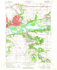
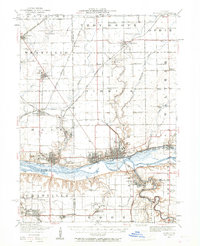
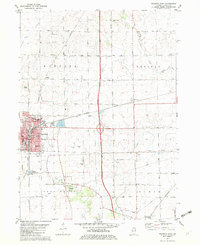
1966 Map of La Salle
USGS Topo · Published 1968This historical map portrays the area of La Salle in 1966, primarily covering LaSalle. Featuring a scale of 1:24000, this map provides a highly detailed snapshot of the terrain, roads, buildings, counties, and historical landmarks in the La Salle region at the time. Published in 1968, it is one of 3 known editions of this map due to revisions or reprints.
Find a feature on this map
53 named features on this map. Tap any name to fly to it.
Don’t see what you’re looking for? This feature index may not catch every label — zoom into the map to look around manually.
Map Details
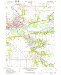
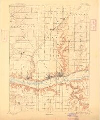
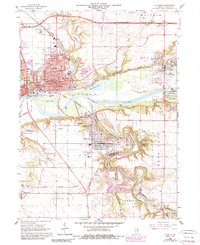
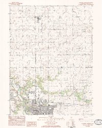
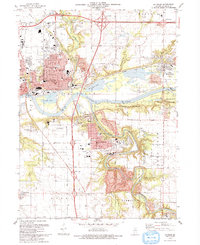
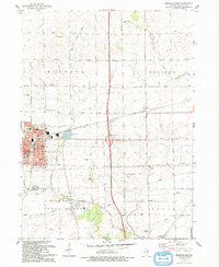
Editions of this 1966 La Salle Map
3 editions found
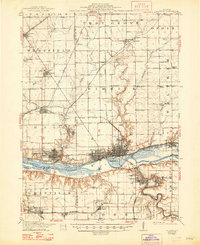
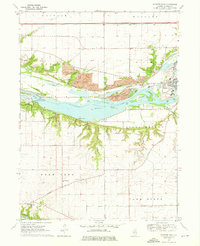
Historical Maps of Cedar Point Through Time
11 maps found
1893 Lasalle
LaSalle County, IL

1911 La Salle
LaSalle County, IL
1913 La Salle
LaSalle County, IL
1947 La Salle
LaSalle County, IL
1966 La Salle
LaSalle County, IL
1970 Prairie Center
LaSalle County, IL
1970 Starved Rock
LaSalle County, IL
1982 Mendota East
LaSalle County, IL
1983 Streator North
LaSalle County, IL
1993 La Salle
LaSalle County, IL
1993 Mendota East
LaSalle County, IL