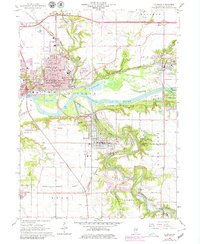
1966 Map of La Salle
USGS Topo · Published 1979About this map
The industrial and riverfront landscape of Peru and La Salle is defined by a complex network of railroads and heavy industry during the mid-to-late 20th century. The Illinois River serves as the central artery, flanked by the Chicago Rock Island and Pacific and the Chicago Burlington and Quincy railroads. To the south, Oglesby is anchored by its Cement Plant and several Quarry sites, illustrating the region's reliance on mineral extraction.
Find a feature on this map
70 named features on this map. Tap any name to fly to it.
Don’t see what you’re looking for? This feature index may not catch every label — zoom into the map to look around manually.
Map Details
Editions of this 1966 La Salle Map
3 editions found
Other maps of this area

1892 · Ottawa
USGS Topo · 1:62,500

1893 · Lasalle
USGS Topo · 1:62,500

1911 · La Salle
USGS Topo · 1:62,500

1913 · La Salle
USGS Topo · 1:62,500

1915 · Ottawa
USGS Topo · 1:62,500

1925 · Streator
USGS Topo · 1:62,500

1927 · Streator
USGS Topo · 1:62,500

1934 · Wenona
USGS Topo · 1:48,000

1939 · Wenona
USGS Topo · 1:62,500

1946 · Ottawa
USGS Topo · 1:62,500