2022 Map of La Salle
USGS Topo · Published 2022About this map
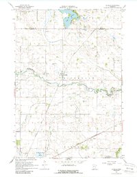
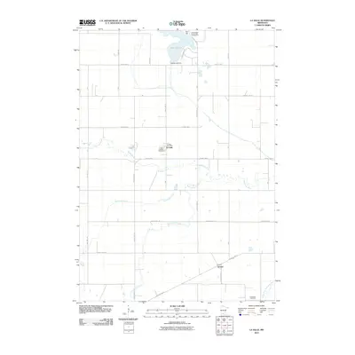
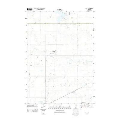
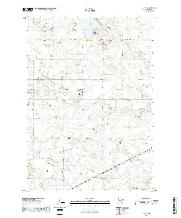
Watonwan River and its southern fork carve a winding path through this agricultural landscape on the border of Brown and Watonwan counties. The settlement of La Salle serves as a central point for the surrounding farmsteads, anchored by the La Salle Lutheran Cem at the town's edge. To the south, the community of Grogan sits along the Hammond Hwy, while the southern reaches of Lake Hanska dominate the northern boundary near Ft Hill. This 2022 survey illustrates a region defined by its water management, showing the intricate drainage provided by Butterfield Cr, Saint James Cr, and the marshy basin of One Hundred Acre Slough. The rectilinear grid of county roads, including Co Hwy 14 and Co Hwy 16, connects remote cemeteries like Rosendale Cem to the local centers of commerce and faith.
Find a feature on this map
39 named features on this map. Tap any name to fly to it.
Don’t see what you’re looking for? This feature index may not catch every label — zoom into the map to look around manually.
Map Details
Editions of this 2022 La Salle Map
This is the sole edition of this map. No revisions or reprints were ever made.
Historical Maps of La Salle Through Time
6 maps found