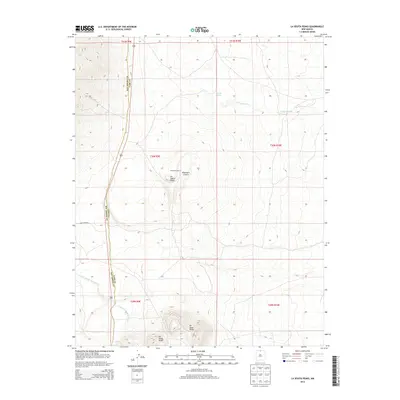
2013 Map of La Segita Peaks
USGS Topo · Published 2013About this map
The volcanic landscape of the Rio Grande Plateau is defined by the prominent cinder cones and basins along the Rio Arriba and Taos County line. Central to this survey are the La Segita Peaks and the neighboring Wissmath Craters, which rise above the high-elevation volcanic fields. The topography is shaped by internal drainage and intermittent watercourses, most notably the seasonal catchment of Punche Lake and the drainage of Arroyo Punche to the northeast. To the south, the massive rising terrain of the No Agua Peaks dominates the horizon, while the Arroyo Aguaje de la Petaca carves through the lower elevations. Human infrastructure is minimal in this high-desert environment, primarily restricted to the winding corridor of Forest Road 87, which provides access through the expansive public lands of the Carson National Forest region.
Find a feature on this map
14 named features on this map. Tap any name to fly to it.
Don’t see what you’re looking for? This feature index may not catch every label — zoom into the map to look around manually.
Map Details
Editions of this 2013 La Segita Peaks Map
This is the sole edition of this map. No revisions or reprints were ever made.
Other maps of this area

1918 · Tusas
USGS Topo · 1:125,000

1954 · Raton
USGS Topo · 1:250,000

1954 · Aztec
USGS Topo · 1:250,000

1958 · Raton
USGS Topo · 1:250,000

1958 · Aztec
USGS Topo · 1:250,000

1962 · Aztec
USGS Topo · 1:250,000
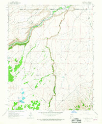
1963 · Los Pinos
USGS Topo · 1:24,000

1963 · Pinabetoso Peaks
USGS Topo · 1:24,000

1963 · Tres Piedras NE
USGS Topo · 1:24,000

1963 · Cerro De La Olla
USGS Topo · 1:24,000