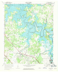
1968 Map of La Vergne
USGS Topo · Published 1971About this map
The J Percy Priest Reservoir dominates this landscape, its waters backing up into the Stones River and numerous tributaries like Suggs Creek and Smith Springs Creek. This 1960s revision illustrates the significant hydrological changes to the region as the reservoir reached its normal pool elevation of 490 feet, altering the traditional boundaries between Nashville-Davidson and Rutherford counties.
Find a feature on this map
51 named features on this map. Tap any name to fly to it.
Don’t see what you’re looking for? This feature index may not catch every label — zoom into the map to look around manually.
Map Details
Editions of this 1968 La Vergne Map
3 editions found
Other maps of this area

1903 · Nashville
USGS Topo · 1:125,000

1916 · Murfreesboro
USGS Topo · 1:62,500

1932 · Hermitage
USGS Topo · 1:62,500

1942 · Lebanon
USGS Topo · 1:100,000

1950 · Walterhill
USGS Topo · 1:24,000

1951 · Martha
USGS Topo · 1:24,000

1952 · Hermitage
USGS Topo · 1:24,000

1952 · La Vergne
USGS Topo · 1:24,000

1952 · Nashville East
USGS Topo · 1:24,000

1952 · Antioch
USGS Topo · 1:24,000