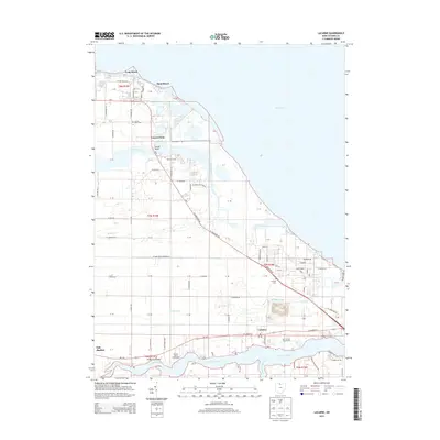
2013 Map of Lacarne
USGS Topo · Published 2013About this map
The Lake Erie shoreline in Ottawa County defines this coastal landscape, stretching from Long Beach southeast past the small lakeside clusters of Sand Beach and Locust Point. This region serves as a critical transition between the open waters of the lake and the fertile agricultural land of the interior, drained by the Toussaint River and Portage River. Local history is anchored by long-standing community institutions such as the Ottawa County Fairgrounds and the Ottawa County Home, while the military presence at Camp Perry and the grounds of the Port Clinton Golf Course indicate the area's diverse land use for recreation and defense. Further inland, the settlement of Lacarne sits near the headwaters of Lacarpe Cr, providing a detailed look at the rural road networks like W Fritchie Rd and N Leutz Rd that connect these lakefront communities to the broader county seat at Oak Harbor.
Find a feature on this map
64 named features on this map. Tap any name to fly to it.
Don’t see what you’re looking for? This feature index may not catch every label — zoom into the map to look around manually.
Map Details
Editions of this 2013 Lacarne Map
This is the sole edition of this map. No revisions or reprints were ever made.
Other maps of this area

1900 · Oak Harbor
USGS Topo · 1:62,500

1901 · Put-In-Bay
USGS Topo · 1:62,500

1901 · Bellevue
USGS Topo · 1:62,500

1901 · Fremont
USGS Topo · 1:62,500

1903 · Bellevue
USGS Topo · 1:62,500

1903 · Fremont
USGS Topo · 1:62,500

1903 · Put In Bay
USGS Topo · 1:62,500

1952 · Oak Harbor
USGS Topo · 1:24,000

1952 · Lacarne
USGS Topo · 1:24,000

1952 · Oak Harbor
USGS Topo · 1:62,500