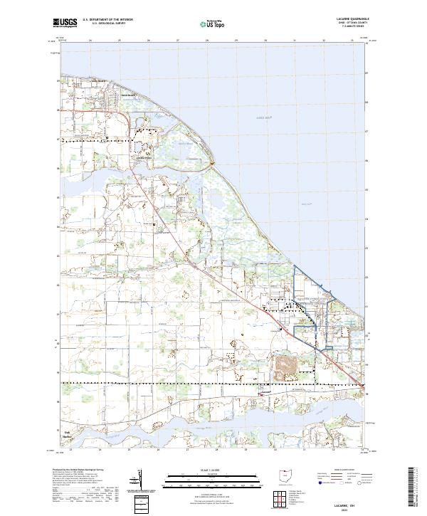
2023 Map of Lacarne
USGS Topo · Published 2023About this map
Lake Erie defines the northern reaches of this coastal Ohio landscape, where vast wetlands like Navarre Marsh and Toussaint Marsh dictate the pattern of human settlement. The map traces a complex network of waterways, from the winding Portage River near Oak Harbor to the smaller Lacarpe Creek and Rusha Creek. These natural features separate small lakefront communities such as Long Beach and Sand Beach from inland settlements like Lacarne. Local genealogy is well-supported by the inclusion of several burying grounds, including Locust Point Cem, Rusha Cem, and Lacarpe Cem. The transition from the developed Paradise Acres to the preserved marshlands highlights the region's historical reliance on both the Great Lakes shoreline and the rich drainage basins of the interior.
Find a feature on this map
62 named features on this map. Tap any name to fly to it.
Don’t see what you’re looking for? This feature index may not catch every label — zoom into the map to look around manually.
Map Details
Editions of this 2023 Lacarne Map
This is the sole edition of this map. No revisions or reprints were ever made.
Other maps of this area

1900 · Oak Harbor
USGS Topo · 1:62,500

1901 · Put-In-Bay
USGS Topo · 1:62,500

1901 · Bellevue
USGS Topo · 1:62,500

1901 · Fremont
USGS Topo · 1:62,500

1903 · Bellevue
USGS Topo · 1:62,500

1903 · Fremont
USGS Topo · 1:62,500

1903 · Put In Bay
USGS Topo · 1:62,500

1952 · Oak Harbor
USGS Topo · 1:24,000

1952 · Lacarne
USGS Topo · 1:24,000

1952 · Oak Harbor
USGS Topo · 1:62,500