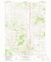
1981 Map of Lacelle
USGS Topo · Published 1981About this map
Lacelle and Leslie anchor this agricultural landscape in southern Iowa during the early 1980s, where the terrain is defined by a dense network of branching tributaries. The drainage patterns of Bee Creek, Spring Creek, and Wolf Creek shape the rural road grid, illustrating the challenges of managing water across the townships of Knox and Ward. This survey highlights the intersection of public infrastructure and local history, capturing functional sites like a Weigh Station and Pumping Station alongside longstanding community landmarks. Genealogists can locate the Lacelle Cemetery and Green Bay Cemetery, which serve as physical markers of the area's early settlement. The map also records the precise boundary where Clarke County and Decatur County meet, providing a clear view of land divisions and rural property lines at the time of the survey.
Find a feature on this map
22 named features on this map. Tap any name to fly to it.
Don’t see what you’re looking for? This feature index may not catch every label — zoom into the map to look around manually.
Map Details
Editions of this 1981 Lacelle Map
This is the sole edition of this map. No revisions or reprints were ever made.
Other maps of this area

1950 · New Virginia
USGS Topo · 1:62,500

1951 · Osceola
USGS Topo · 1:62,500

1952 · New Virginia
USGS Topo · 1:62,500

1954 · Centerville
USGS Topo · 1:250,000

1954 · Des Moines
USGS Topo · 1:250,000

1956 · Des Moines
USGS Topo · 1:250,000

1957 · Des Moines
USGS Topo · 1:250,000

1957 · Centerville
USGS Topo · 1:250,000

1958 · Centerville
USGS Topo · 1:250,000

1965 · Weldon
USGS Topo · 1:24,000