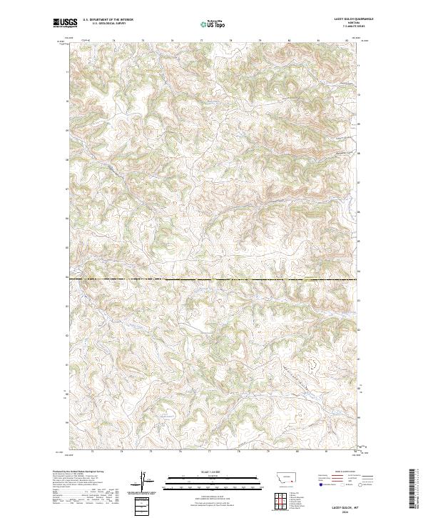
2024 Map of Lacey Gulch
USGS Topo · Published 2024About this map
Lacey Gulch defines this section of the Montana landscape, where the border between Rosebud and Big Horn counties cuts through a complex network of drainages and ridgelines. The area is characterized by seasonal waterways and named draws that have likely served as landmarks for generations of ranchers and land managers. Significant water features include Hanging Woman Creek in the northeast and Wrench Creek, which meanders across the central terrain. The road network is sparse, primarily consisting of Hanging Woman Creek Rd and Decker Rd, reflecting the remote, rural character of these high plains. Notable terrain features like Deadman Gulch and Van Meter Gulch suggest a landscape shaped by local history and topography, while several springs indicate the vital and scattered water sources necessary for life in this arid environment.
Find a feature on this map
19 named features on this map. Tap any name to fly to it.
Don’t see what you’re looking for? This feature index may not catch every label — zoom into the map to look around manually.
Map Details
Editions of this 2024 Lacey Gulch Map
This is the sole edition of this map. No revisions or reprints were ever made.
Other maps of this area

1954 · Hardin
USGS Topo · 1:250,000

1957 · Hardin
USGS Topo · 1:250,000

1958 · Hardin
USGS Topo · 1:250,000

1966 · Browns Mountain
USGS Topo · 1:24,000

1967 · Holmes Ranch
USGS Topo · 1:24,000

1967 · Birney
USGS Topo · 1:24,000

1967 · Lacey Gulch
USGS Topo · 1:24,000
1967 · Pine Butte School
USGS Topo · 1:24,000
1967 · Spring Gulch
USGS Topo · 1:24,000
1967 · Birney SW
USGS Topo · 1:24,000