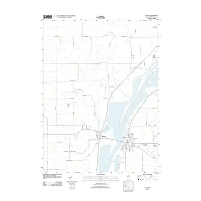
2012 Map of Lacon
USGS Topo · Published 2012About this map
The Illinois River dominates this portion of Marshall County, creating a complex hydrologic landscape where the main channel is flanked by significant backwaters like Goose Lake, Wightman Lake, and Billsbach Lake. On the eastern bank, the city of Lacon serves as a regional hub, connected by bridge to the village of Sparland to the west. This river corridor has long been the primary driver of development in the area, shaping the layout of local roads and the placement of aviation facilities like the Marshall County Airport.
Find a feature on this map
67 named features on this map. Tap any name to fly to it.
Don’t see what you’re looking for? This feature index may not catch every label — zoom into the map to look around manually.
Map Details
Editions of this 2012 Lacon Map
This is the sole edition of this map. No revisions or reprints were ever made.
Other maps of this area

1893 · Lacon
USGS Topo · 1:62,500

1893 · Metamora
USGS Topo · 1:62,500

1893 · Dunlap
USGS Topo · 1:62,500

1898 · Dunlap
USGS Topo · 1:62,500

1932 · Dunlap
USGS Topo · 1:62,500

1933 · Dunlap
USGS Topo · 1:62,500

1933 · Lacon
USGS Topo · 1:62,500

1933 · Camp Grove
USGS Topo · 1:48,000

1937 · Metamora
USGS Topo · 1:62,500

1937 · Dunlap
USGS Topo · 1:62,500