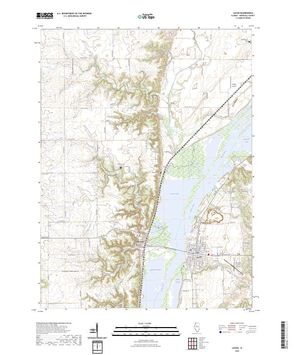
2024 Map of Lacon
USGS Topo · Published 2024About this map
The Illinois River corridor dominates this Marshall County landscape, where the community of Lacon serves as a prominent riverfront hub. On the eastern bank, the town's grid is anchored by the Marshall County Courthouse, while the village of Sparland sits directly across the water to the west. The river environment is defined by a complex network of backwater features, including Goose Lake, Babb Slough, and Wightman Lake, much of which is protected within the Chautauqua National Wildlife Refuge. Away from the valley floor, the terrain rises into dissected bluffs cut by drainages like Crow Creek and Gimlet Creek. This modern survey also preserves the locations of several local burial grounds, such as Nighswonger Cem and Bonham Cem, providing clear spatial context for genealogical research in this river-valley setting.
Find a feature on this map
77 named features on this map. Tap any name to fly to it.
Don’t see what you’re looking for? This feature index may not catch every label — zoom into the map to look around manually.
Map Details
Editions of this 2024 Lacon Map
This is the sole edition of this map. No revisions or reprints were ever made.
Other maps of this area

1893 · Lacon
USGS Topo · 1:62,500

1893 · Metamora
USGS Topo · 1:62,500

1893 · Dunlap
USGS Topo · 1:62,500

1898 · Dunlap
USGS Topo · 1:62,500

1932 · Dunlap
USGS Topo · 1:62,500

1933 · Dunlap
USGS Topo · 1:62,500

1933 · Lacon
USGS Topo · 1:62,500

1933 · Camp Grove
USGS Topo · 1:48,000

1937 · Metamora
USGS Topo · 1:62,500

1937 · Dunlap
USGS Topo · 1:62,500