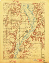
1893 Map of Lacon
USGS Topo · Published 1902About this map
The Illinois River dominates this nineteenth-century survey, creating a complex network of backwater lakes and marshes that defined the local economy and transport before modern dredging. Extensive wetlands including Senachwine Lake, Goose Lake, and Saw Mill Lake flank the main channel, illustrating the seasonal floodplains of the era. The settlement of Lacon serves as a primary hub, while Henry is shown with its grid and a prominent Lock on the river. The landscape is also shaped by competing transit systems, with the Chicago Rock Island and Pacific Railway running north-south through Putnam and Sparland, while the Chicago and Alton Railroad cuts east-west across the southern prairie. Small rural localities like Cottage Hill and Whitefield anchor the surrounding townships, providing key points of interest for genealogists tracing family roots in Marshall and Putnam counties.
Find a feature on this map
33 named features on this map. Tap any name to fly to it.
Don’t see what you’re looking for? This feature index may not catch every label — zoom into the map to look around manually.
Map Details
Editions of this 1893 Lacon Map
4 editions found
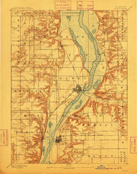
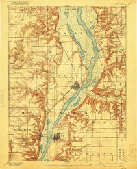
Other maps of this area

1893 · Lacon
USGS Topo · 1:62,500

1893 · Hennepin
USGS Topo · 1:62,500

1893 · Metamora
USGS Topo · 1:62,500

1893 · Dunlap
USGS Topo · 1:62,500

1893 · Lasalle
USGS Topo · 1:62,500

1898 · Dunlap
USGS Topo · 1:62,500

1909 · Hennepin
USGS Topo · 1:62,500

1911 · La Salle
USGS Topo · 1:62,500

1911 · Hennepin
USGS Topo · 1:62,500

1913 · La Salle
USGS Topo · 1:62,500