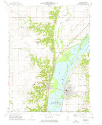
1972 Map of Lacon
USGS Topo · Published 1974About this map
The Illinois River dominates this mid-1970s landscape, flanked by the sprawling backwaters of Goose Lake, Weis Lake, and Wightman Lake. This riparian corridor is heavily defined by conservation efforts, including the Cameron National Wildlife Refuge and the Marshall County State Conservation Area. On the eastern bank, Lacon serves as a hub of activity with its grid-style streets, Marshall County Airport, and local infrastructure like the Sewage Disposal plant.
Find a feature on this map
44 named features on this map. Tap any name to fly to it.
Don’t see what you’re looking for? This feature index may not catch every label — zoom into the map to look around manually.
Map Details
Editions of this 1972 Lacon Map
2 editions found
Other maps of this area

1893 · Lacon
USGS Topo · 1:62,500

1893 · Metamora
USGS Topo · 1:62,500

1893 · Dunlap
USGS Topo · 1:62,500

1898 · Dunlap
USGS Topo · 1:62,500

1932 · Dunlap
USGS Topo · 1:62,500

1933 · Dunlap
USGS Topo · 1:62,500

1933 · Lacon
USGS Topo · 1:62,500

1933 · Camp Grove
USGS Topo · 1:48,000

1937 · Metamora
USGS Topo · 1:62,500

1937 · Dunlap
USGS Topo · 1:62,500