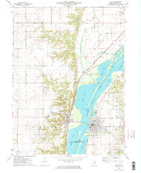
1972 Map of Lacon
USGS Topo · Published 1974About this map
The Illinois River valley dominates this early 1970s survey, serving as a corridor for heavy industry, conservation, and transportation. The city of Lacon sits on the eastern bank, supported by the Illinois Central Gulf railroad and the Marshall County Airport. Across the water, the village of Sparland connects to the western shore near the Chicago Rock Island and Pacific line.
Find a feature on this map
39 named features on this map. Tap any name to fly to it.
Don’t see what you’re looking for? This feature index may not catch every label — zoom into the map to look around manually.
Map Details
Editions of this 1972 Lacon Map
2 editions found
Other maps of this area

1893 · Lacon
USGS Topo · 1:62,500

1893 · Metamora
USGS Topo · 1:62,500

1893 · Dunlap
USGS Topo · 1:62,500

1898 · Dunlap
USGS Topo · 1:62,500

1932 · Dunlap
USGS Topo · 1:62,500

1933 · Dunlap
USGS Topo · 1:62,500

1933 · Lacon
USGS Topo · 1:62,500

1933 · Camp Grove
USGS Topo · 1:48,000

1937 · Metamora
USGS Topo · 1:62,500

1937 · Dunlap
USGS Topo · 1:62,500