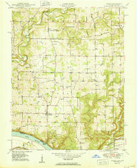
1950 Map of Laconia
USGS Topo · Published 1950About this map
Big Buck Creek and its winding tributaries define the landscape of south-central Harrison County, Indiana, as it appeared in the mid-20th century. The settlement of Laconia serves as a central hub, surrounded by a dense network of family cemeteries and rural institutions like St Michaels Ch and Rehoboth Sch. The map documents a rural economy transitioning between traditional agriculture and early industrial activity, evidenced by the numerous natural gas wells marked throughout the township and Siepels Quarry to the north.
Find a feature on this map
46 named features on this map. Tap any name to fly to it.
Don’t see what you’re looking for? This feature index may not catch every label — zoom into the map to look around manually.
Map Details
Editions of this 1950 Laconia Map
2 editions found
Other maps of this area

1909 · Kosmosdale
USGS Topo · 1:48,000

1912 · Kosmosdale
USGS Topo · 1:62,500

1931 · Corydon
USGS Topo · 1:62,500

1936 · Vine Grove
USGS Topo · 1:62,500

1941 · Ekron
USGS Topo · 1:62,500

1943 · Vine Grove
USGS Topo · 1:62,500

1944 · Corydon West
USGS Topo · 1:24,000

1946 · Rock Haven
USGS Topo · 1:24,000

1946 · Fort Knox
USGS Topo · 1:24,000

1946 · Vine Grove
USGS Topo · 1:62,500