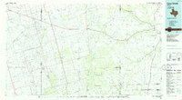
1986 Map of Lacy Creek
USGS Topo · Published 1986About this map
The vast petroleum landscape of the Permian Basin dominates this 1980s map of West Texas. Centered on Garden City, the county seat of Glasscock County, the map reveals a dense network of roads and pipelines serving an extensive Oil Field that stretches across several county lines. To the south, Saint Lawrence serves as a secondary focal point for the agricultural and energy-focused communities in the region.
Find a feature on this map
67 named features on this map. Tap any name to fly to it.
Don’t see what you’re looking for? This feature index may not catch every label — zoom into the map to look around manually.
Map Details
Editions of this 1986 Lacy Creek Map
2 editions found
Other maps of this area

1895 · Sherwood
USGS Topo · 1:125,000

1921 · Ketchum Mountain
USGS Topo · 1:62,500

1923 · Ketchum Mountain
USGS Topo · 1:62,500

1928 · Crane
USGS Topo · 1:125,000

1928 · Rankin
USGS Topo · 1:125,000

1941 · Morita
USGS Topo · 1:62,500

1941 · Big Spring South
USGS Topo · 1:62,500

1942 · Big Spring South
USGS Topo · 1:62,500

1949 · Morita
USGS Topo · 1:62,500

1954 · Hobbs
USGS Topo · 1:250,000