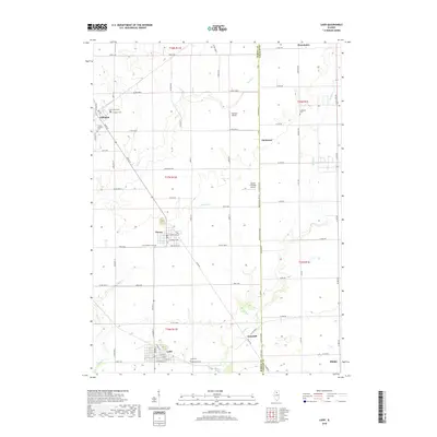
2018 Map of Ladd
USGS Topo · Published 2018About this map
The village of Ladd and its surrounding agricultural landscape dominate this study of the border between Bureau and LaSalle counties. The settlement pattern is defined by traditional Midwestern grid-iron towns like Cherry and Arlington, connected by a network of county roads. A poignant historical detail is preserved at the Cherry Miner's Cem, while other burial sites like Lost Grove Cem and Lutheran Cem reflect the diverse early community. Small private airfields, including Funfsinn Airport and the Gerald H Hamer Airport, are situated among the fields, suggesting the modern utility of these rural spaces. Waterways such as Brush Cr, Negro Cr, and Spring Cr meander through the landscape, creating the only breaks in an otherwise strictly surveyed territory of section lines and townships.
Find a feature on this map
56 named features on this map. Tap any name to fly to it.
Don’t see what you’re looking for? This feature index may not catch every label — zoom into the map to look around manually.
Map Details
Editions of this 2018 Ladd Map
This is the sole edition of this map. No revisions or reprints were ever made.
Other maps of this area

1893 · Hennepin
USGS Topo · 1:62,500

1893 · Lasalle
USGS Topo · 1:62,500

1909 · Hennepin
USGS Topo · 1:62,500

1911 · La Salle
USGS Topo · 1:62,500

1911 · Hennepin
USGS Topo · 1:62,500

1913 · La Salle
USGS Topo · 1:62,500

1947 · La Salle
USGS Topo · 1:62,500

1951 · Amboy
USGS Topo · 1:62,500

1952 · Mendota
USGS Topo · 1:62,500

1958 · Aurora
USGS Topo · 1:250,000