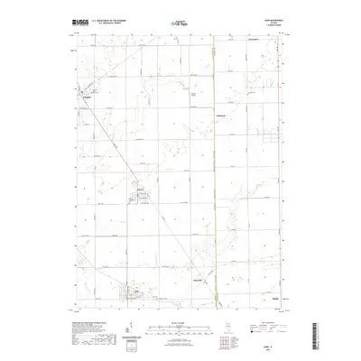
2021 Map of Ladd
USGS Topo · Published 2021About this map
Ladd and the neighboring village of Cherry anchor this portrait of north-central Illinois, where the landscape is defined by the transition from the Illinois River valley toward the flat upland prairies. The area is marked by its coal mining legacy, evidenced by the Miners Memorial Cem and the proximity of the northern edge of Peru. The drainage of Negro Cr and Spring Cr carves distinct patterns into the agricultural grid, while the Bureau and LaSalle county line bisects the territory north-to-south through Fitchmoor. Small rural centers like Arlington and Churchill remain connected by a dense network of country roads, including North Main Street and East 2nd Road, supporting a tradition of dispersed settlements and local community hubs such as Arlington Lost Grove Cem and the Funfsinn Airport.
Find a feature on this map
68 named features on this map. Tap any name to fly to it.
Don’t see what you’re looking for? This feature index may not catch every label — zoom into the map to look around manually.
Map Details
Editions of this 2021 Ladd Map
This is the sole edition of this map. No revisions or reprints were ever made.
Other maps of this area

1893 · Hennepin
USGS Topo · 1:62,500

1893 · Lasalle
USGS Topo · 1:62,500

1909 · Hennepin
USGS Topo · 1:62,500

1911 · La Salle
USGS Topo · 1:62,500

1911 · Hennepin
USGS Topo · 1:62,500

1913 · La Salle
USGS Topo · 1:62,500

1947 · La Salle
USGS Topo · 1:62,500

1951 · Amboy
USGS Topo · 1:62,500

1952 · Mendota
USGS Topo · 1:62,500

1958 · Aurora
USGS Topo · 1:250,000