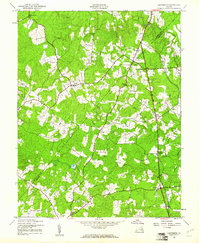
1942 Map of Ladysmith
USGS Topo · Published 1961About this map
Ladysmith and its surrounding rural hamlets are mapped here as they appeared during the early 1940s, situated along the critical north-south corridor through Caroline Co. The landscape is defined by its numerous family-named junctions and river crossings, such as Blades Corner and Hams Ford, which served as the social and commercial hubs for this agricultural region. The network of small communities including Marye, Cedon, and Blantons is interspersed with significant local congregations at Beulah Ch and Bethany Ch.
Find a feature on this map
23 named features on this map. Tap any name to fly to it.
Don’t see what you’re looking for? This feature index may not catch every label — zoom into the map to look around manually.
Map Details
Editions of this 1942 Ladysmith Map
2 editions found

Other maps of this area

1887 · Spottsylvania
USGS Topo · 1:125,000

1889 · Fredericksburg
USGS Topo · 1:125,000

1890 · Goochland
USGS Topo · 1:125,000

1892 · Fredericksburg
USGS Topo · 1:125,000

1892 · Spottsylvania
USGS Topo · 1:125,000

1892 · Goochland
USGS Topo · 1:125,000

1894 · Fredericksburg
USGS Topo · 1:125,000

1918 · Doswell
USGS Topo · 1:62,500

1942 · Woodford
USGS Topo · 1:31,680

1942 · Guinea
USGS Topo · 1:31,680