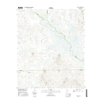
2016 Map of Lafayette
USGS Topo · Published 2016About this map
The settlement of LaFayette sits at the intersection of local routes in the southern portion of this landscape, where the county line separates Upshur and Camp counties. The terrain is defined by a series of prominent peaks and ridges, including Massey Mtn, Adams Mtn, and Couch Mtn, which rise above the complex network of creeks and sloughs. To the north, Big Cypress Creek meanders along the border of Titus and Camp counties, surrounded by low-lying wetlands such as Burton Slough and Big Slough. This region exhibits a rural pattern of development, where family-named landmarks like Pat Miller Hill and Wilks Mtn provide orientation between small community centers. Genealogists may find value in the locations of Pleasant Grove Cem and Slaton Cem, which serve the populations around Lee Springs and the surrounding woodlands.
Find a feature on this map
80 named features on this map. Tap any name to fly to it.
Don’t see what you’re looking for? This feature index may not catch every label — zoom into the map to look around manually.
Map Details
Editions of this 2016 Lafayette Map
This is the sole edition of this map. No revisions or reprints were ever made.
Other maps of this area

1914 · Daingerfield
USGS Topo · 1:62,500

1953 · Texarkana
USGS Topo · 1:250,000

1956 · Texarkana
USGS Topo · 1:250,000

1956 · Tyler
USGS Topo · 1:250,000

1960 · Bettie
USGS Topo · 1:24,000

1960 · Coffeeville
USGS Topo · 1:24,000

1960 · La Fayette
USGS Topo · 1:24,000

1960 · Pittsburg
USGS Topo · 1:24,000

1962 · Ore City
USGS Topo · 1:24,000

1962 · Lone Star
USGS Topo · 1:24,000