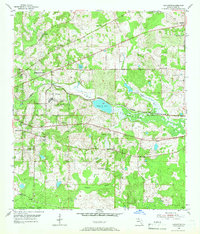
1954 Map of Lafayette
USGS Topo · Published 1966About this map
The settlement of Lafayette and its surrounding countryside in Leon County are captured here during the mid-1950s, showing a landscape defined by religious centers and evolving infrastructure. The map reveals a dense network of country churches serving local congregations, including New Zion Ch, Mt Olive Ch, and Mt Sinai Ch. Education and health are represented by the Ward School and Edwards Hospital, while the large Federal Correctional Institution and its associated Prison Farm occupy a significant tract of land in the central part of the quadrangle.
Find a feature on this map
33 named features on this map. Tap any name to fly to it.
Don’t see what you’re looking for? This feature index may not catch every label — zoom into the map to look around manually.
Map Details
Editions of this 1954 Lafayette Map
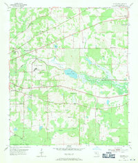
Other maps of this area

1940 · Tallahassee
USGS Topo · 1:62,500

1942 · Tallahassee
USGS Topo · 1:62,500

1943 · Tallahassee
USGS Topo · 1:62,500

1954 · Lloyd
USGS Topo · 1:24,000

1954 · Lafayette
USGS Topo · 1:24,000

1954 · Cody
USGS Topo · 1:24,000

1954 · Woodville
USGS Topo · 1:24,000

1954 · Tallahassee
USGS Topo · 1:250,000

1959 · Tallahassee
USGS Topo · 1:250,000

1960 · Tallahassee
USGS Topo · 1:250,000