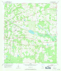
1954 Map of Lafayette
USGS Topo · Published 1971About this map
Lake Lafayette and its surrounding wetlands dominate the central portion of this 1950s-era topographic survey, just east of the state capital. This period shows a landscape defined by institutional development and a high density of rural religious centers. The Federal Correctional Institution and an adjacent Prison Farm represent significant state infrastructure of the time, while the smaller community of Perkins sits along the Seaboard Air Line railroad.
Find a feature on this map
34 named features on this map. Tap any name to fly to it.
Don’t see what you’re looking for? This feature index may not catch every label — zoom into the map to look around manually.
Map Details
Editions of this 1954 Lafayette Map
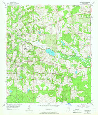
Other maps of this area

1940 · Tallahassee
USGS Topo · 1:62,500

1942 · Tallahassee
USGS Topo · 1:62,500

1943 · Tallahassee
USGS Topo · 1:62,500

1954 · Lloyd
USGS Topo · 1:24,000

1954 · Lafayette
USGS Topo · 1:24,000

1954 · Cody
USGS Topo · 1:24,000

1954 · Woodville
USGS Topo · 1:24,000

1954 · Tallahassee
USGS Topo · 1:250,000

1959 · Tallahassee
USGS Topo · 1:250,000

1960 · Tallahassee
USGS Topo · 1:250,000