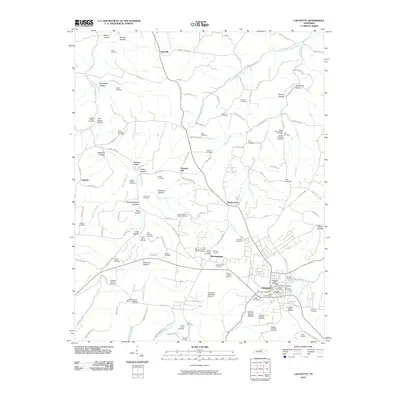
2010 Map of Lafayette
USGS Topo · Published 2010About this map
The town of Lafayette serves as the focal point of this 2010 survey of Macon County, Tennessee, showing a landscape defined by deeply carved hollows and a dense network of family cemeteries. The settlement pattern follows the ridgelines and valley floors, with small communities like Haysville, Maple Grove, and Brattontown connected by winding routes such as Old Hwy 52. The sheer number of burial grounds, including the Livingston - Adams Cemetery, David Blankenship Cemetery, and the Mooningham - White - Robertson Cemetery, provides a remarkable record of local lineage and early family settlements throughout the region.
Find a feature on this map
132 named features on this map. Tap any name to fly to it.
Don’t see what you’re looking for? This feature index may not catch every label — zoom into the map to look around manually.
Map Details
Editions of this 2010 Lafayette Map
This is the sole edition of this map. No revisions or reprints were ever made.
Other maps of this area

1931 · Lafayette
USGS Topo · 1:62,500

1931 · Red Boiling Springs
USGS Topo · 1:62,500

1932 · Carthage
USGS Topo · 1:62,500

1954 · Fountain Run
USGS Topo · 1:24,000

1954 · Petroleum
USGS Topo · 1:24,000

1954 · Holland
USGS Topo · 1:24,000

1956 · Corbin
USGS Topo · 1:250,000

1956 · Nashville
USGS Topo · 1:250,000

1958 · Corbin
USGS Topo · 1:250,000

1958 · Westmoreland
USGS Topo · 1:24,000