
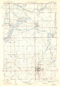
1947 Map of Lagrange
USGS Topo · Published 1947About this map
The Lagrange county seat serves as the anchor of this mid-century survey, showcasing a landscape defined by the serpentine paths of the Pigeon River and Fawn River. The transition between the rural townships of Lima, Clay, and Bloomfield is marked by a high concentration of small educational and religious landmarks, including the prominent campus of the Howe Military Sch and isolated country schools like Saylor Sch and Green Sch.
Find a feature on this map
29 named features on this map. Tap any name to fly to it.
Don’t see what you’re looking for? This feature index may not catch every label — zoom into the map to look around manually.
Map Details
Editions of this 1947 Lagrange Map
2 editions found
Other maps of this area

1914 · Three Rivers
USGS Topo · 1:62,500

1916 · Three Rivers
USGS Topo · 1:62,500

1943 · Three Rivers
USGS Topo · 1:62,500

1947 · Mongo
USGS Topo · 1:24,000

1947 · Wolcottville
USGS Topo · 1:24,000

1947 · Oliver Lake
USGS Topo · 1:24,000

1953 · Fort Wayne
USGS Topo · 1:250,000

1956 · Fort Wayne
USGS Topo · 1:250,000

1959 · Wolcottville
USGS Topo · 1:24,000

1959 · Topeka
USGS Topo · 1:24,000