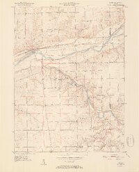
1951 Map of Lagro
USGS Topo · Published 1951About this map
The confluence of the Wabash River and the Salamonie River defines this 1951 topographic survey of Wabash County. The town of Lagro sits at a strategic bend in the Wabash, showing the early layout of its streets and rail infrastructure. To the south, the landscape is deeply carved by the Salamonie, where the Salamonie River State Forest surrounds the Hominy Ridge Lake. This area reveals a rural settlement pattern where life centered around small crossroads communities and country parishes.
Find a feature on this map
28 named features on this map. Tap any name to fly to it.
Don’t see what you’re looking for? This feature index may not catch every label — zoom into the map to look around manually.
Map Details
Editions of this 1951 Lagro Map
2 editions found
Other maps of this area

1950 · Lagro
USGS Topo · 1:24,000

1950 · Andrews
USGS Topo · 1:24,000

1950 · Mount Etna
USGS Topo · 1:24,000

1951 · Mount Etna
USGS Topo · 1:24,000

1951 · Andrews
USGS Topo · 1:24,000

1951 · Lagro
USGS Topo · 1:24,000

1952 · Wabash
USGS Topo · 1:24,000

1953 · La Fontaine
USGS Topo · 1:24,000

1953 · Somerset
USGS Topo · 1:24,000

1953 · Muncie
USGS Topo · 1:250,000