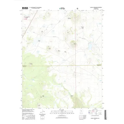
2017 Map of Laguna Canoneros
USGS Topo · Published 2017About this map
Casa Fria sits at the heart of this high-desert landscape within the Cibola National Forest, where the transition from McKinley to Cibola County is marked across a terrain of volcanic plugs and seasonal basins. The geography is defined by numerous natural catchments and named tanks such as Laguna Cañoneros and Laguna de Frances, essential water sources in an area dominated by prominent heights like Mesa Chivato and Cerro Redondo. The drainage network includes the Arroyo Cañoneros and Seboyeta Creek, which channel seasonal runoff through deep incisions like Seboyeta Canyon. Human modification of the landscape is evident in the uniquely named Panama Canal irrigation or drainage feature and a network of Forest Service routes, including 555 Road, which provide access through the complex topography of the Cañon de Pedro Padilla and past landmarks like Cerro Ortiz.
Find a feature on this map
44 named features on this map. Tap any name to fly to it.
Don’t see what you’re looking for? This feature index may not catch every label — zoom into the map to look around manually.
Map Details
Editions of this 2017 Laguna Canoneros Map
This is the sole edition of this map. No revisions or reprints were ever made.
Other maps of this area

1883 · Mt. Taylor
USGS Topo · 1:250,000

1886 · Mt. Taylor
USGS Topo · 1:250,000

1892 · Mt. Taylor
USGS Topo · 1:250,000

1899 · Mt. Taylor
USGS Topo · 1:250,000

1957 · Mount Taylor
USGS Topo · 1:24,000

1957 · Moquino
USGS Topo · 1:24,000

1957 · Seboyeta
USGS Topo · 1:24,000

1958 · Albuquerque
USGS Topo · 1:250,000

1961 · Marquez
USGS Topo · 1:24,000

1961 · El Dado Mesa
USGS Topo · 1:24,000