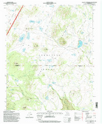
1995 Map of Laguna Canoneros
USGS Topo · Published 1998About this map
The Cebolleta Mesa Grant dominates this high-desert landscape in northwestern New Mexico, characterized by a series of volcanic peaks and ephemeral water sources. Large-scale ranching and seasonal grazing patterns are evident through the presence of scattered outposts like Cuates Camp, Cañoneros Camp, and Casa Fria. These settlements represent the human footprint on the land, supported by an extensive network of water tanks such as John Nelson Tank and Chute Grand Tank.
Find a feature on this map
41 named features on this map. Tap any name to fly to it.
Don’t see what you’re looking for? This feature index may not catch every label — zoom into the map to look around manually.
Map Details
Editions of this 1995 Laguna Canoneros Map
This is the sole edition of this map. No revisions or reprints were ever made.
Other maps of this area

1883 · Mt. Taylor
USGS Topo · 1:250,000

1886 · Mt. Taylor
USGS Topo · 1:250,000

1892 · Mt. Taylor
USGS Topo · 1:250,000

1899 · Mt. Taylor
USGS Topo · 1:250,000

1957 · Mount Taylor
USGS Topo · 1:24,000

1957 · Moquino
USGS Topo · 1:24,000

1957 · Seboyeta
USGS Topo · 1:24,000

1958 · Albuquerque
USGS Topo · 1:250,000

1961 · Marquez
USGS Topo · 1:24,000

1961 · El Dado Mesa
USGS Topo · 1:24,000