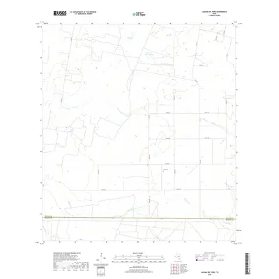
2019 Map of Laguna Del Toro
USGS Topo · Published 2019About this map
Copita Cem stands as a quiet focal point in this south Texas landscape, which is defined by a complex network of seasonal drainages and shallow depressions. The geography is dominated by the winding course of Cibolo Cr and its tributaries, including Ramada del Toro Cr and Laborcitas Cr. These ephemeral watercourses flow through a region characterized by significant natural catchments like Laguna del Toro and Laguna Grande, which likely serve as critical water sources in an otherwise semi-arid environment. Located along the boundary of Duval and Brooks counties, the map reveals a remote ranching territory organized by a grid of county roads and state secondary highways. The arrangement of tracks like Co RD 238 and FM 1329 suggests a landscape of large landholdings where traditional Texas ranching remains the primary use of the land.
Find a feature on this map
22 named features on this map. Tap any name to fly to it.
Don’t see what you’re looking for? This feature index may not catch every label — zoom into the map to look around manually.
Map Details
Editions of this 2019 Laguna Del Toro Map
This is the sole edition of this map. No revisions or reprints were ever made.
Other maps of this area

1921 · Falfurrias
USGS Topo · 1:125,000

1956 · Laredo
USGS Topo · 1:250,000

1963 · Premont West
USGS Topo · 1:24,000

1963 · Falfurrias
USGS Topo · 1:24,000
1963 · Seeligson Ranch
USGS Topo · 1:24,000

1968 · Palomas Ranch NW
USGS Topo · 1:24,000

1968 · Concepcion
USGS Topo · 1:24,000

1968 · Concepcion NW
USGS Topo · 1:24,000

1968 · Palomas Ranch
USGS Topo · 1:24,000
1969 · Laguna Del Toro
USGS Topo · 1:24,000