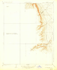
1923 Map of Laguna Seca Ranch
USGS Topo · Published 1928About this map
Laguna Seca Ranch stands as the primary landmark in this study of the arid foothills and drainage patterns along the Merced and Fresno county line. The topography is dominated by the deeply incised path of Little Panoche Creek, which winds through the eastern portion of the map. The landscape reflects the rural character of the San Joaquin Valley periphery in the early 1920s, defined by large landholdings and natural watercourses before modern irrigation and development transformed the region. The detailed 1920 topography focuses on the transition from the high ridges to the creek bed, illustrating the geographical constraints that dictated early ranching boundaries and transit routes in this part of California. This specific survey provides a fine-scale look at the terrain before it was subsumed into larger regional quadrangles.
Find a feature on this map
4 named features on this map. Tap any name to fly to it.
Don’t see what you’re looking for? This feature index may not catch every label — zoom into the map to look around manually.
Map Details
Editions of this 1923 Laguna Seca Ranch Map
3 editions found
Other maps of this area

1913 · Panoche
USGS Topo · 1:125,000

1920 · Carrisalito Spring
USGS Topo · 1:31,680

1921 · Laguna Seca Ranch
USGS Topo · 1:31,680

1921 · Tierra Loma School
USGS Topo · 1:31,680

1922 · Charleston School
USGS Topo · 1:31,680

1922 · Dos Palos
USGS Topo · 1:31,680

1922 · Ortigalita
USGS Topo · 1:31,680

1923 · Laguna Seca Ranch
USGS Topo · 1:31,680

1923 · Tierra Loma School
USGS Topo · 1:31,680

1923 · Little Panoche
USGS Topo · 1:31,680