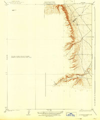
1923 Map of Laguna Seca Ranch
USGS Topo · Published 1942About this map
Laguna Seca Ranch anchors this western San Joaquin Valley landscape during a period of transition in California's land use. The topography shows the dramatic rise from the flat valley floor into the steep foothills of the Diablo Range, where the drainage of Little Panoche Creek cuts a deep path through the terrain. The map captures the political boundary of the Merced and Fresno county line as it traverses this isolated ranch land. This survey provides a precise look at the 1920s irrigation and land management patterns, including the network of secondary roads and section lines that structured the cattle ranching and early agricultural efforts in this arid region before the large-scale water projects of the later 20th century.
Find a feature on this map
4 named features on this map. Tap any name to fly to it.
Don’t see what you’re looking for? This feature index may not catch every label — zoom into the map to look around manually.
Map Details
Editions of this 1923 Laguna Seca Ranch Map
3 editions found
Other maps of this area

1913 · Panoche
USGS Topo · 1:125,000

1920 · Carrisalito Spring
USGS Topo · 1:31,680

1921 · Laguna Seca Ranch
USGS Topo · 1:31,680

1921 · Tierra Loma School
USGS Topo · 1:31,680

1922 · Charleston School
USGS Topo · 1:31,680

1922 · Dos Palos
USGS Topo · 1:31,680

1922 · Ortigalita
USGS Topo · 1:31,680

1923 · Laguna Seca Ranch
USGS Topo · 1:31,680

1923 · Tierra Loma School
USGS Topo · 1:31,680

1923 · Little Panoche
USGS Topo · 1:31,680