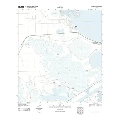
2010 Map of Laguna Vista
USGS Topo · Published 2010About this map
The coastal wetlands and coastal prairies of Cameron County are intricately detailed in this 2010 study of the shoreline. The settlement of Laguna Vista sits overlooking the expansive Laguna Madre, while the nearby Laguna Heights and Rutherford-Harding Addition Colonia mark the residential corridor. Significant topographical and hydrological features define the interior, including the broad Bahia Grande and San Martin Lake. Historic navigation and transit routes are visible through landmarks such as La Aura Crossing and Carretas Crossing, which hint at older land-use patterns across the coastal ridges. Modern infrastructure, including the Brownsville Ship Channel and the Cameron County Fwsd Dam 1, shows the engineering required to manage the delicate balance between the Gulf waters and the inland basins. Smaller landforms like Bird Island and Loma la Cuchilla provide reference points for the low-lying terrain of the Texas coast.
Find a feature on this map
34 named features on this map. Tap any name to fly to it.
Don’t see what you’re looking for? This feature index may not catch every label — zoom into the map to look around manually.
Map Details
Editions of this 2010 Laguna Vista Map
This is the sole edition of this map. No revisions or reprints were ever made.
Other maps of this area

1929 · La Coma
USGS Topo · 1:24,000

1929 · Palmito Hill
USGS Topo · 1:24,000

1929 · Point Isabel
USGS Topo · 1:24,000

1929 · Laguna Vista
USGS Topo · 1:24,000

1930 · Padre Island No. 1
USGS Topo · 1:24,000

1930 · Los Fresnos
USGS Topo · 1:24,000

1930 · Laguna Atascosa
USGS Topo · 1:24,000

1930 · East Brownsville
USGS Topo · 1:24,000

1934 · Port Isabel
USGS Topo · 1:31,680

1934 · La Coma
USGS Topo · 1:31,680
Featured Places
- Brownsville, TX
- Port Isabel, TX
- Laguna Vista, TX
- Rutherford-Harding Addition Colonia, TX
- La Aura Crossing, Brownsville