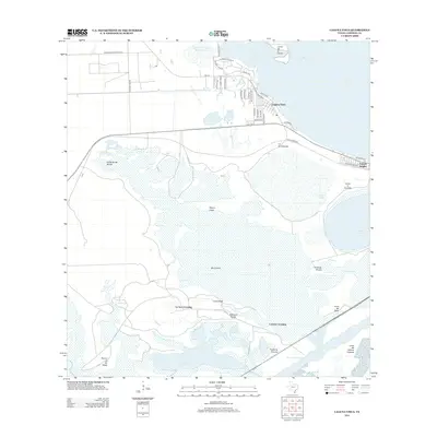
2013 Map of Laguna Vista
USGS Topo · Published 2013About this map
Laguna Vista and its residential street network anchor this coastal landscape near the southern tip of Texas. The town is marked by local roads like Golf House Rd and Whooping Crane Dr, reflecting a community integrated with the surrounding wetlands. Further south, the map reveals a shift toward the industrial and maritime corridor of the Brownsville Ship Channel, which borders several prominent landmarks including Puerta de Trancas and Loma del Potrero Cercado.
Find a feature on this map
51 named features on this map. Tap any name to fly to it.
Don’t see what you’re looking for? This feature index may not catch every label — zoom into the map to look around manually.
Map Details
Editions of this 2013 Laguna Vista Map
This is the sole edition of this map. No revisions or reprints were ever made.
Other maps of this area

1929 · La Coma
USGS Topo · 1:24,000

1929 · Palmito Hill
USGS Topo · 1:24,000

1929 · Point Isabel
USGS Topo · 1:24,000

1929 · Laguna Vista
USGS Topo · 1:24,000

1930 · Padre Island No. 1
USGS Topo · 1:24,000

1930 · Los Fresnos
USGS Topo · 1:24,000

1930 · Laguna Atascosa
USGS Topo · 1:24,000

1930 · East Brownsville
USGS Topo · 1:24,000

1934 · Port Isabel
USGS Topo · 1:31,680

1934 · La Coma
USGS Topo · 1:31,680
Featured Places
- Brownsville, TX
- Port Isabel, TX
- Laguna Vista, TX
- Rutherford-Harding Addition Colonia, TX
- La Aura Crossing, Brownsville