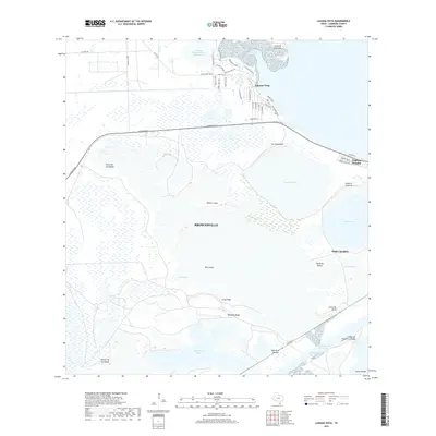
2019 Map of Laguna Vista
USGS Topo · Published 2019About this map
The coastal wetlands and lomas of the lower Texas coast define this landscape north of Brownsville. The community of Laguna Vista sits elevated on the northern shore of Laguna Vista Cove, where residential streets like Country Club Dr and Palo Blanco Dr give way to the sprawling tidal flats of El Tular. To the east, Laguna Heights and Port Isabel flank the shoreline, serving as gateways to the bay.
Find a feature on this map
56 named features on this map. Tap any name to fly to it.
Don’t see what you’re looking for? This feature index may not catch every label — zoom into the map to look around manually.
Map Details
Editions of this 2019 Laguna Vista Map
This is the sole edition of this map. No revisions or reprints were ever made.
Other maps of this area

1929 · La Coma
USGS Topo · 1:24,000

1929 · Palmito Hill
USGS Topo · 1:24,000

1929 · Point Isabel
USGS Topo · 1:24,000

1929 · Laguna Vista
USGS Topo · 1:24,000

1930 · Padre Island No. 1
USGS Topo · 1:24,000

1930 · Los Fresnos
USGS Topo · 1:24,000

1930 · Laguna Atascosa
USGS Topo · 1:24,000

1930 · East Brownsville
USGS Topo · 1:24,000

1934 · Port Isabel
USGS Topo · 1:31,680

1934 · La Coma
USGS Topo · 1:31,680
Featured Places
- Brownsville, TX
- Port Isabel, TX
- Laguna Vista, TX
- Rutherford-Harding Addition Colonia, TX
- La Aura Crossing, Brownsville