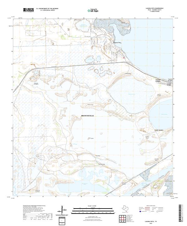
2022 Map of Laguna Vista
USGS Topo · Published 2022About this map
Coastal wetlands and low-lying lomas define the landscape of the southern Texas coast near the Brownsville Ship Channel. The settlement of Laguna Vista sits overlooking Laguna Vista Cove, where residential streets like Ocelot Trail Rd and Palo Blanco Dr suggest a modern community established around the natural topography of the Lower Rio Grande Valley. The map captures an intricate system of lagoons and inland water bodies, including Laguna Larga and the expansive San Martin Lake. Historically significant landforms known as lomas, such as Loma de la Grulla and Loma la Cuchilla, rise above the surrounding flats, providing crucial elevation in a region dominated by the Intracoastal Waterway. This survey documents the transition from the developed heights to the marshy expanses of Rincon Largo and the bird habitats of Bird Island.
Find a feature on this map
55 named features on this map. Tap any name to fly to it.
Don’t see what you’re looking for? This feature index may not catch every label — zoom into the map to look around manually.
Map Details
Editions of this 2022 Laguna Vista Map
This is the sole edition of this map. No revisions or reprints were ever made.
Other maps of this area

1929 · La Coma
USGS Topo · 1:24,000

1929 · Palmito Hill
USGS Topo · 1:24,000

1929 · Point Isabel
USGS Topo · 1:24,000

1929 · Laguna Vista
USGS Topo · 1:24,000

1930 · Padre Island No. 1
USGS Topo · 1:24,000

1930 · Los Fresnos
USGS Topo · 1:24,000

1930 · Laguna Atascosa
USGS Topo · 1:24,000

1930 · East Brownsville
USGS Topo · 1:24,000

1934 · Port Isabel
USGS Topo · 1:31,680

1934 · La Coma
USGS Topo · 1:31,680
Featured Places
- Brownsville, TX
- Port Isabel, TX
- Laguna Vista, TX
- Rutherford-Harding Addition Colonia, TX
- Laguna Heights, TX