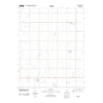
2009 Map of Lahoma
USGS Topo · Published 2009About this map
Lahoma and Carrier anchor this Garfield County landscape, illustrating the grid-based development of the Oklahoma plains in the early twenty-first century. The area is defined by its agricultural layout, with a network of section-line roads like N2770 Rd and E0410 Rd facilitating travel between small rural hubs. Water management is a visible priority, evidenced by the Oknoname 04702 Dam and its associated Oknoname 04702 Reservoir, while Turkey Creek winds through the southern portion of the quadrangle. For genealogists and local historians, the presence of Rose Hill Cemetery, Zion Cemetery, and Lahoma Cemetery provides essential geographic markers for family research. The location of the Vernon School further points to the historical distribution of community services across this productive prairie region.
Find a feature on this map
26 named features on this map. Tap any name to fly to it.
Don’t see what you’re looking for? This feature index may not catch every label — zoom into the map to look around manually.
Map Details
Editions of this 2009 Lahoma Map
This is the sole edition of this map. No revisions or reprints were ever made.
Other maps of this area

1955 · Enid West
USGS Topo · 1:24,000

1955 · Enid
USGS Topo · 1:250,000

1955 · Woodward
USGS Topo · 1:250,000

1956 · Enid
USGS Topo · 1:62,500

1956 · Ringwood
USGS Topo · 1:62,500

1958 · Enid
USGS Topo · 1:250,000

1958 · Woodward
USGS Topo · 1:250,000

1968 · Hillsdale
USGS Topo · 1:24,000

1969 · Goltry
USGS Topo · 1:24,000

1969 · Jet SE
USGS Topo · 1:24,000