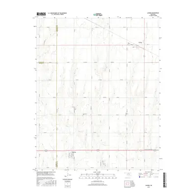
2016 Map of Lahoma
USGS Topo · Published 2016About this map
The town of Lahoma serves as the primary hub in this Garfield County landscape, situated along the southern edge of the map. The region is defined by a grid-like network of rural roads that connect small agricultural settlements and communal spaces. To the north, Carrier sits at a junction of local thoroughfares like Maple St and Main St. The survey reveals a high density of historical burial grounds distributed across the plains, including Rose Hill Cem, Zion Cem, Lahoma Cem, and Baumagartner Cem, suggesting a long-established rural community and providing significant value for genealogical research. The natural drainage of the land is visible through the winding course of Turkey Cr, which cuts through the southwestern corner of the quadrangle. This area also marks several political boundaries, where the edges of Alfalfa and Major counties meet Garfield County at the County Line.
Find a feature on this map
48 named features on this map. Tap any name to fly to it.
Don’t see what you’re looking for? This feature index may not catch every label — zoom into the map to look around manually.
Map Details
Editions of this 2016 Lahoma Map
This is the sole edition of this map. No revisions or reprints were ever made.
Other maps of this area

1955 · Enid West
USGS Topo · 1:24,000

1955 · Enid
USGS Topo · 1:250,000

1955 · Woodward
USGS Topo · 1:250,000

1956 · Enid
USGS Topo · 1:62,500

1956 · Ringwood
USGS Topo · 1:62,500

1958 · Enid
USGS Topo · 1:250,000

1958 · Woodward
USGS Topo · 1:250,000

1968 · Hillsdale
USGS Topo · 1:24,000

1969 · Goltry
USGS Topo · 1:24,000

1969 · Jet SE
USGS Topo · 1:24,000