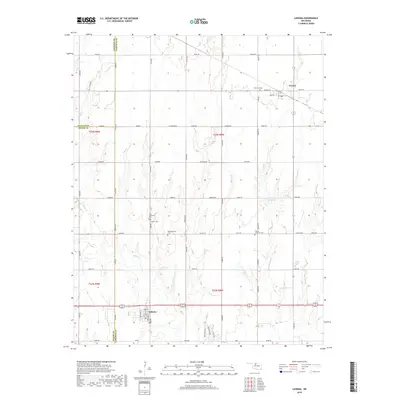
2018 Map of Lahoma
USGS Topo · Published 2018About this map
Lahoma and Carrier anchor this section of the Oklahoma plains, where the grid-based settlement pattern of Garfield County is clearly visible. The landscape is defined by agricultural section lines and the drainage of Turkey Cr, which winds through the central portion of the survey. For those researching local heritage, the map is remarkably dense with burial grounds, including the Zion Lutheran Cem and Trinity Lutheran Cem, alongside the Baumgartner Cem and Rose Hill Cem. These sites, often positioned near rural intersections or early congregation centers, offer a window into the community's ancestral footprint. Modern infrastructure like Indian Dam Rd and the local Reservoir show the ongoing management of water in this prairie environment, while the town sites of Lahoma and Carrier maintain their historic street plans centered on corridors like Main St and Oklahoma St.
Find a feature on this map
51 named features on this map. Tap any name to fly to it.
Don’t see what you’re looking for? This feature index may not catch every label — zoom into the map to look around manually.
Map Details
Editions of this 2018 Lahoma Map
This is the sole edition of this map. No revisions or reprints were ever made.
Other maps of this area

1955 · Enid West
USGS Topo · 1:24,000

1955 · Enid
USGS Topo · 1:250,000

1955 · Woodward
USGS Topo · 1:250,000

1956 · Enid
USGS Topo · 1:62,500

1956 · Ringwood
USGS Topo · 1:62,500

1958 · Enid
USGS Topo · 1:250,000

1958 · Woodward
USGS Topo · 1:250,000

1968 · Hillsdale
USGS Topo · 1:24,000

1969 · Goltry
USGS Topo · 1:24,000

1969 · Jet SE
USGS Topo · 1:24,000