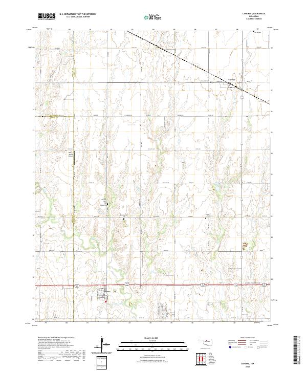
2022 Map of Lahoma
USGS Topo · Published 2022About this map
Lahoma and Carrier anchor this section of the Oklahoma plains, illustrating a settlement pattern defined by the Public Land Survey System and agricultural transport corridors. The landscape is bisected by the meandering Turkey Cr, which provides the primary natural drainage through a grid of section roads like Purdue Ave and e0380 RD. A high concentration of rural cemeteries, including Rose Hill Cem, Zion Lutheran Cem, and Baumagartner Cem, reflects the long-standing community foundations of the Garfield County area. Notable aviation footprints are seen at the TLC Airport and Black I Ranch Airport, while the 04702 Reservoir serves as a modern water management feature. The map also delineates the meeting of multiple jurisdictions at the border of Alfalfa and Garfield counties, where the straight lines of the township and range system dictate the local geography.
Find a feature on this map
54 named features on this map. Tap any name to fly to it.
Don’t see what you’re looking for? This feature index may not catch every label — zoom into the map to look around manually.
Map Details
Editions of this 2022 Lahoma Map
This is the sole edition of this map. No revisions or reprints were ever made.
Other maps of this area

1955 · Enid West
USGS Topo · 1:24,000

1955 · Enid
USGS Topo · 1:250,000

1955 · Woodward
USGS Topo · 1:250,000

1956 · Enid
USGS Topo · 1:62,500

1956 · Ringwood
USGS Topo · 1:62,500

1958 · Enid
USGS Topo · 1:250,000

1958 · Woodward
USGS Topo · 1:250,000

1968 · Hillsdale
USGS Topo · 1:24,000

1969 · Goltry
USGS Topo · 1:24,000

1969 · Jet SE
USGS Topo · 1:24,000