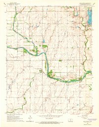
1965 Map of Lake Afton
USGS Topo · Published 1966About this map
The confluence of the North Fork Ninnescah River and South Fork Ninnescah River anchors this mid-century look at the prairie landscape of western Sedgwick County. The map captures a transition in land use, where traditional agrarian sections in townships like Morton and Erie meet the recreational development surrounding Lake Afton. The creation of Afton County Park and Clear Lake indicates a shift toward public leisure spaces, complete with picnic areas and campgrounds, while the Lake Afton Boys Ranch and Camp Hyde mark specific institutional and youth-oriented footprints on the land.
Find a feature on this map
21 named features on this map. Tap any name to fly to it.
Don’t see what you’re looking for? This feature index may not catch every label — zoom into the map to look around manually.
Map Details
Editions of this 1965 Lake Afton Map
2 editions found

Other maps of this area

1889 · Cheney
USGS Topo · 1:125,000

1889 · Caldwell
USGS Topo · 1:125,000

1891 · Cheney
USGS Topo · 1:125,000

1893 · Caldwell
USGS Topo · 1:125,000

1897 · Caldwell
USGS Topo · 1:125,000

1901 · Cheney
USGS Topo · 1:125,000

1955 · Wichita
USGS Topo · 1:250,000

1958 · Wichita
USGS Topo · 1:250,000

1964 · Cheney
USGS Topo · 1:24,000

1965 · Garden Plain
USGS Topo · 1:24,000