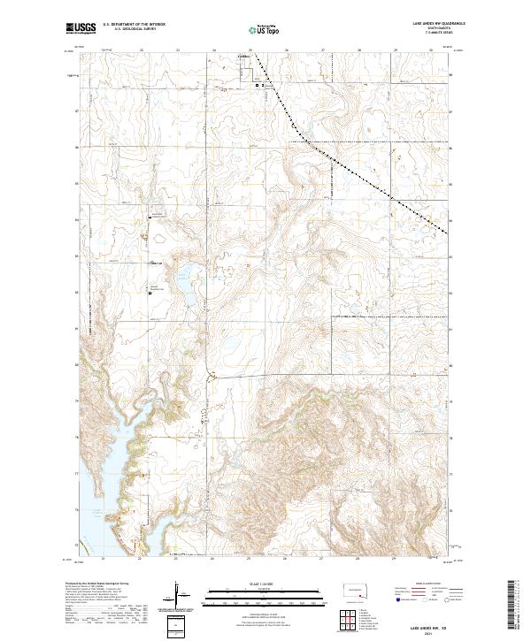
2021 Map of Lake Andes NW
USGS Topo · Published 2021About this map
Geddes serves as the primary northern hub of this landscape in Charles Mix County, where the transition from flat prairie to the dissected bluffs of the Missouri trench is evident. The town is flanked by historic burial grounds including Saint Anns Cem and Pleasant Lawn Cem, providing essential touchstones for genealogical research in this rural corridor. Further south, the terrain becomes increasingly complex as Pease Cr and Spring Cr carve deep draws toward the water.
Find a feature on this map
34 named features on this map. Tap any name to fly to it.
Don’t see what you’re looking for? This feature index may not catch every label — zoom into the map to look around manually.
Map Details
Editions of this 2021 Lake Andes NW Map
This is the sole edition of this map. No revisions or reprints were ever made.
Other maps of this area

1955 · Mitchell
USGS Topo · 1:250,000

1959 · Mitchell
USGS Topo · 1:250,000

1964 · Campbell Creek
USGS Topo · 1:24,000

1964 · Lake Andes NW
USGS Topo · 1:24,000

1964 · Fort Randall Dam
USGS Topo · 1:24,000

1964 · Lake Andes SW
USGS Topo · 1:24,000
1964 · South Scalp Creek
USGS Topo · 1:24,000

1964 · Lake Andes
USGS Topo · 1:24,000

1977 · Lake Andes NW
USGS Topo · 1:24,000
1977 · Lake Andes
USGS Topo · 1:24,000
Featured Places
- Geddes, SD
- Goose Lake Township, SD
- White Swan Township, SD
- Jackson Township, SD
- Pease Creek Hutterite Colony, SD