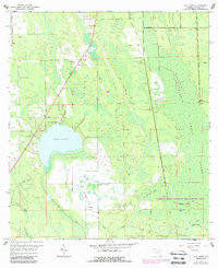
1966 Map of Lake Ashby
USGS Topo · Published 1988About this map
Lake Ashby dominates this central Volusia County landscape, surrounded by a complex network of wetlands and drainage canals that speak to the region's managed hydrology in the mid-1960s. The settlement at Alamana and the nearby Lake Ashby Shores development represent the era's residential footprint, while the Ashby Lookout Tower stands as a sentinel over the extensive marshes and cypress stands. To the south and east, the Farmton State Wildlife Management Area preserves a more primitive environment, including islands like Watson Island and Rattlesnake Island within the Harris Bay area.
Find a feature on this map
31 named features on this map. Tap any name to fly to it.
Don’t see what you’re looking for? This feature index may not catch every label — zoom into the map to look around manually.
Map Details
Editions of this 1966 Lake Ashby Map
3 editions found
Other maps of this area

1937 · Port Orange
USGS Topo · 1:48,000

1943 · Port Orange
USGS Topo · 1:62,500

1944 · Port Orange
USGS Topo · 1:62,500

1949 · Osceola
USGS Topo · 1:24,000

1950 · Maytown
USGS Topo · 1:24,000

1950 · Edgewater
USGS Topo · 1:24,000

1952 · Samsula
USGS Topo · 1:24,000

1954 · Daytona Beach
USGS Topo · 1:250,000

1955 · Orlando
USGS Topo · 1:250,000

1956 · New Smyrna Beach
USGS Topo · 1:24,000