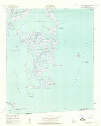
1955 Map of Lake Athanasio
USGS Topo · Published 1959About this map
Lake Athanasio dominates this mid-century survey of the Mississippi River Delta's outer marshes, where the land fragmenting into the Gulf of Mexico creates a complex network of bays and islands. The boundary between St Bernard Parish and Plaquemines Parish cuts through the lower reaches of the map, just north of where Bayou Terre aux Boeufs enters Black Bay. This is a landscape shaped by shifting tides and sediment, evidenced by the intricate maze of wetlands surrounding Seven Dollar Bay and St Helena Bay. Navigational markers like Lake Eloi Light 1 and Mozambique Point Light serve as vital landmarks for mariners threading through Pass Fernandez or crossing into the open waters of Breton Sound. The presence of small landforms such as Coon Nest Island and Deadman Island provides a glimpse into the coastal geography before decades of accelerated subsidence and erosion.
Find a feature on this map
29 named features on this map. Tap any name to fly to it.
Don’t see what you’re looking for? This feature index may not catch every label — zoom into the map to look around manually.
Map Details
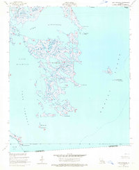
Editions of this 1955 Lake Athanasio Map
2 editions found
Other maps of this area

1893 · La Fortuna
USGS Topo · 1:62,500

1893 · Shell Beach
USGS Topo · 1:62,500

1893 · Dime
USGS Topo · 1:62,500

1895 · Bodreau
USGS Topo · 1:62,500

1935 · Morgan Harbor
USGS Topo · 1:31,680

1935 · Lake Athanasio
USGS Topo · 1:31,680

1935 · Lake Calebasse
USGS Topo · 1:31,680

1939 · Shell Beach
USGS Topo · 1:62,500

1941 · Black Bay
USGS Topo · 1:62,500

1941 · Shell Beach
USGS Topo · 1:62,500