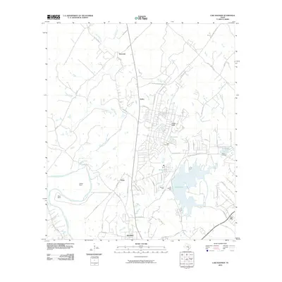
2010 Map of Lake Bastrop
USGS Topo · Published 2010About this map
Lake Bastrop dominates the southeastern quadrant of this region, its shoreline shaped by the Lake Bastrop Dam and Sanders Dam. To the north, the sprawling residential and historical footprint of Camp Swift is clearly delineated, showing a dense network of streets like Pershing Blvd and Texas Ranger Dr. This area, north of the city of Bastrop, represents a landscape of transitioning utility, where military history meets modern residential growth.
Find a feature on this map
63 named features on this map. Tap any name to fly to it.
Don’t see what you’re looking for? This feature index may not catch every label — zoom into the map to look around manually.
Map Details
Editions of this 2010 Lake Bastrop Map
This is the sole edition of this map. No revisions or reprints were ever made.
Other maps of this area

1885 · Bastrop
USGS Topo · 1:125,000

1893 · Bastrop
USGS Topo · 1:125,000

1904 · Bastrop
USGS Topo · 1:125,000

1948 · Smithville
USGS Topo · 1:62,500

1948 · Elgin
USGS Topo · 1:62,500

1948 · Bastrop
USGS Topo · 1:62,500

1948 · Lexington
USGS Topo · 1:62,500

1950 · Lexington
USGS Topo · 1:62,500

1950 · Bastrop
USGS Topo · 1:62,500

1950 · Smithville
USGS Topo · 1:62,500