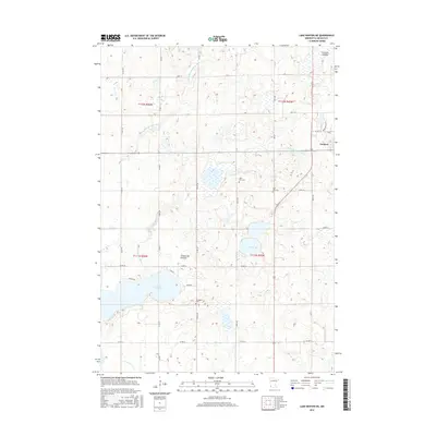
2016 Map of Lake Benton NE
USGS Topo · Published 2016About this map
Ivanhoe serves as the primary center of settlement in this part of Lincoln County, situated at the intersection of CO Hwy 25 and CO Hwy 15. The landscape is dominated by the high plateau of the Coteau des Prairies, which dictates the drainage patterns of the region's many watercourses. The headwaters of the Yellow Medicine River divide here, with both the N Br Yellow Medicine River and the S Br Yellow Medicine River carving through the prairie.
Find a feature on this map
30 named features on this map. Tap any name to fly to it.
Don’t see what you’re looking for? This feature index may not catch every label — zoom into the map to look around manually.
Map Details
Editions of this 2016 Lake Benton NE Map
This is the sole edition of this map. No revisions or reprints were ever made.
Other maps of this area

1953 · Watertown
USGS Topo · 1:250,000

1958 · Watertown
USGS Topo · 1:250,000

1963 · Tyler
USGS Topo · 1:24,000

1963 · Arco
USGS Topo · 1:24,000
1967 · Porter SW
USGS Topo · 1:24,000

1967 · Lake Benton NW
USGS Topo · 1:24,000

1967 · Lake Benton
USGS Topo · 1:24,000

1967 · Canby SE
USGS Topo · 1:24,000

1967 · Lake Benton SW
USGS Topo · 1:24,000

1967 · Hendricks
USGS Topo · 1:24,000