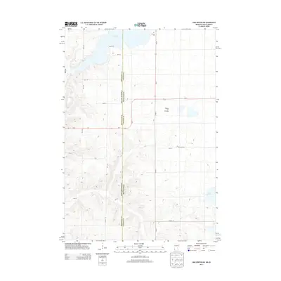
2013 Map of Lake Benton NW
USGS Topo · Published 2013About this map
Lake Hendricks dominates the northern border of this landscape, marking the transition between the plains of Brookings County and the high country of Lincoln County. This area sits upon the Coteau des Prairies, a massive plateau that shapes the local hydrology and drainage patterns. The state boundary between South Dakota and Minnesota runs vertically through the center of the sheet, bisecting rural townships defined by a rigid grid of section roads like 200th St and 487th Ave. This late-twentieth-century study reveals the persistent agricultural character of the region, where family history is preserved at sites like Trulock Cem and New Grove Cem. In the southeastern corner, the waters of Lake Shaokatan appear alongside the winding course of Deer Creek, illustrating the glacial topography of the upper Midwest.
Find a feature on this map
24 named features on this map. Tap any name to fly to it.
Don’t see what you’re looking for? This feature index may not catch every label — zoom into the map to look around manually.
Map Details
Editions of this 2013 Lake Benton NW Map
This is the sole edition of this map. No revisions or reprints were ever made.
Other maps of this area

1953 · Watertown
USGS Topo · 1:250,000

1958 · Watertown
USGS Topo · 1:250,000

1967 · Lake Benton NW
USGS Topo · 1:24,000

1967 · Lake Benton
USGS Topo · 1:24,000

1967 · Canby SE
USGS Topo · 1:24,000

1967 · Lake Benton SW
USGS Topo · 1:24,000

1967 · Hendricks
USGS Topo · 1:24,000

1967 · Lake Benton NE
USGS Topo · 1:24,000

1970 · White NE
USGS Topo · 1:24,000

1970 · Astoria
USGS Topo · 1:24,000