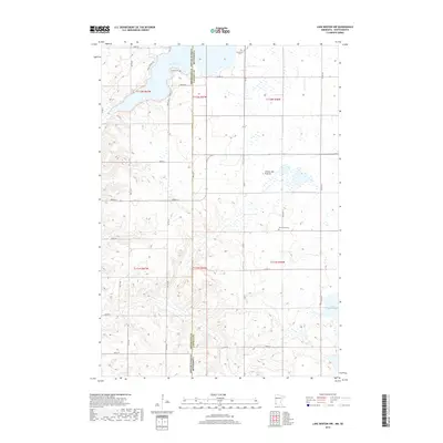
2019 Map of Lake Benton NW
USGS Topo · Published 2019About this map
Lake Hendricks straddles the state line in this 2019 survey of the borderlands between Brookings County, South Dakota, and Lincoln County, Minnesota. The landscape is dominated by the distinctive glacial topography of the Coteau des Prairies, a high plateau where numerous small wetlands and sloughs dot the high ground between larger basins. Local history and genealogy interests are well-represented by several burial sites, including Trulock Cem near the lake shore, Hendricks Cem to the east, and the centrally located New Grove Cem. While much of the land remains agricultural, development is visible along the northern lakefront with Ramlo Shores Dr. To the southeast, the terrain descends toward Lake Shaokatan, while drainage is further defined by the seasonal flow of Deer Cr winding through the western sections.
Find a feature on this map
33 named features on this map. Tap any name to fly to it.
Don’t see what you’re looking for? This feature index may not catch every label — zoom into the map to look around manually.
Map Details
Editions of this 2019 Lake Benton NW Map
This is the sole edition of this map. No revisions or reprints were ever made.
Other maps of this area

1953 · Watertown
USGS Topo · 1:250,000

1958 · Watertown
USGS Topo · 1:250,000

1967 · Lake Benton NW
USGS Topo · 1:24,000

1967 · Lake Benton
USGS Topo · 1:24,000

1967 · Canby SE
USGS Topo · 1:24,000

1967 · Lake Benton SW
USGS Topo · 1:24,000

1967 · Hendricks
USGS Topo · 1:24,000

1967 · Lake Benton NE
USGS Topo · 1:24,000

1970 · White NE
USGS Topo · 1:24,000

1970 · Astoria
USGS Topo · 1:24,000